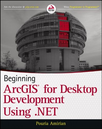
(Ebook PDF) Beginning ArcGIS for Desktop Development using NET 1st Edition by Pouria Amirian ISBN 9781118442531 1118442539 full chapters
$50.00 Original price was: $50.00.$35.00Current price is: $35.00.
Beginning ArcGIS for Desktop Development using NET 1st Edition Pouria Amirian Digital Instant Download
Author(s): Pouria Amirian
ISBN(s): 9781118442548, 1118442547
Edition: 1
File Details: PDF, 27.92 MB
Year: 2013
Language: english
(Ebook PDF) Beginning ArcGIS for Desktop Development using NET 1st Edition by Pouria Amirian-Ebook PDF Instant Download/Delivery:9781118442531, 1118442539
Instant download Full Chapter eginning ArcGIS for Desktop Development using NET 1st Editionof after payment

Product details:
ISBN 10:1118442539
ISBN 13:9781118442531
Author: Pouria Amirian
Get the very most out of the ArcGIS family of software products ArcGIS software manipulates, processes, and presents geospatial data. With it, you can create maps, use them in a variety of applications, compile geographic data, and more. Now you can tailor this powerful tool to your own development needs using VB.NET and C# and the solid guidance in this practical Wrox guide. You’ll get up to speed on ArcGIS tools and artifacts, explore best practices from real-world examples, and learn to program in ArcGIS. The book includes fully functional code and guides you all the way through, from development to deployment. Gets programmers up and running on ArcGIS, a family of software products for creating maps and handling geographic data Shows how to customize and build commands, tools, and extensions using ArcGIS APIs and VB.NET, C#, and Java Covers ArcGIS development through deployment Topics include object orientation and UML, programming in .NET accessing maps and layers, data management, and more Learn how to customize your data and improve your productivity with this powerful tool and Beginning ArcGIS Desktop Development Using .Net.
Table of Contents:
- Part I: The Basics
- Chapter 1: Why Geospatial Is Special
- A Tour of Geospatial Data
- Why Geospatial Is Special
- Various Kinds of GIS Software
- Server GIS
- Desktop GIS
- Developer GIS
- Mobile GIS
- Geospatial Data Models and Storage
- Raster
- Vector
- Geospatial Data as Text or Binary File
- Geospatial Data in Georelational Models
- Geospatial Data Inside Spatial DBMS
- Geospatial Data in XML Structures
- Esri Geodatabase
- Personal Geodatabase
- File Geodatabase
- ArcSDE Geodatabase
- Summary
- Chapter 2: Introduction to ArcGIS for Desktop Applications Customization
- Four Ways to Customize ArcGIS for Desktop
- Customizing the User Interface
- Scripting
- Desktop Add-Ins
- ArcObjects SDK
- Summary
- Part II: .NET Programming Fundamentals
- Chapter 3: .NET Programming Fundamentals, Part I
- The .NET Framework
- The C# Language
- A Brief History of C#
- Basic Concepts
- Variables and Data Types
- Nullable Data Types
- Operations on Variables
- Arrays
- Decision-Making
- Iteration
- Object Manipulation
- Data Type Conversion
- Enumerations
- Methods
- Introduction to Object-Oriented Programming in C#
- Object-Oriented Programming in Action
- Defining Properties
- Defining Methods
- Defining Constructors
- Summary
- Chapter 4: .NET Programming Fundamentals, Part II
- Overview of Object-Oriented Programming Concepts
- Abstraction
- Encapsulation
- Inheritance
- Polymorphism
- Reference Types and Value Types
- Assignment Operations
- Comparison Operations
- Passing Parameters between Method Calls
- Brief Explanation of All .NET Types
- Namespaces and Assemblies
- Debugging Using Visual Studio
- Structured Exception Handling
- Casting Objects
- Aggregation Using Collections
- The ArrayList
- Generics
- Reading and Writing Files
- Summary
- Part III: ArcObjects Programming
- Chapter 5: Understanding ArcObjects Object Model Diagrams
- What Is ArcObjects?
- Interface-Based Programming in Brief
- Understanding Object Model Diagrams
- Types of Classes in ArcObjects
- Relationships between Classes
- Members of Interfaces
- Interface Inheritance
- Wormhole
- Additional Tips for Using Object Model Diagrams
- Where to Start with ArcObjects
- How to Find an Associated Member
- Summary
- Chapter 6: Accessing Maps and Layers
- Introduction to Maps and Layers In ArcObjects
- General Properties of All Layers
- Working with FeatureLayers
- Working with RasterLayers
- Adding an Existing *.lyr File to a Map
- Adding *.lyr Files Using GxDialog
- Saving *.lyr and *.mxd Files
- Summary
- Chapter 7: Working with Tables and FeatureClasses
- Accessing Tables and FeatureClasses
- Adding and Deleting Fields
- Adding Existing FeatureClasses, Tables, and Rasters to a Map
- Deleting an Existing FeatureDataset, FeatureClass, Table, or Raster
- Creating Tables and Rows
- Summary
- Chapter 8: Subsets of Records
- Using Object Model Diagrams for Selecting Features and Rows
- Working with Existing Selections
- Selecting Rows and Features
- Accessing a Subset of Records
- Simple Statistics of Features
- Some Important Points about Using Cursors
- Displaying Subsets of Geospatial Data
- Summary
- Chapter 9: Constructing and Using the Geometry of Features
- Object Model Diagram for the Geometry of Features and Graphics
- Displaying Geometries on the Screen
- Creating and Drawing Points
- Creating and Drawing Multipoints
- Creating and Drawing Polylines
- Creating and Drawing Polygons
- Creating a New Feature and Editing an Existing Feature’s Geometry
- Working with Spatial Operators
- Examining Spatial Relationships
- Common Geoprocessing Operations
- Determining the Nearest Points and Distance
- Length, Area, Centroid, and Envelope of Geometries
- Summary
- Chapter 10: Rendering Geospatial Data and Using Hyperlinks and MapTips
- Geospatial Data Display
- Color and ColorRamp Classes
- Symbols
- Renderers for Vector and Raster Geospatial Data
- Going beyond Simple Display
- Simple and Advanced MapTips
- Hyperlinks
- Summary
- Chapter 11: Labeling, Exporting ActiveView, and Working with Elements
- Labeling
- Labeling with the Default Labeling Engine
- Labeling with the Maplex Labeling Engine
- Exporting the ActiveView
- Working with Elements
- Adding GraphicElements
- Adding FrameElements
- Summary
- Chapter 12: Geoprocessing with Tools and Models
- ArcObjects and the Geoprocessing Framework
- Running Geoprocessing Tools
- Running Custom Tools
- Opening a Tool’s Dialog Box in Code
- Geoprocessing in the Background
- Bach Processing
- Can I Manage the Execution of Geoprocessing Tools?
- Summary
- Chapter 13: Feature Data Management
- Use of GUID in ArcObjects
- Working with the Geodatabase Model
- Creating Geodatabases
- Creating FeatureDatasets and FeatureClasses
- Working with Features
- Creating New Features
- Modifying Existing Features
- Summary
- Chapter 14: Advanced Topics in ArcObjects Programming and Deployment
- Sharing State and Functionality between Components
- Event Handling in ArcObjects
- Application Extension
- Add-In Deployment
- Preparing for Release
- Add-In File Structure
- Distributing and Installing an Add-In
- Custom Component Deployment
- Creating an Installer for Custom Component
- Summary
- Appendix: Answers to Chapter Exercises
People also search:
install arcgis desktop
what is arcgis developer
beginner gis projects
a complete beginner’s guide to arcgis desktop (part 1)
arcgis beginner tutorial
Tags:
ArcGIS,Desktop Development,NET,Pouria Amirian


